23/01/2024 00:00:00 - 14/03/2024 23:59:59
Applications closed
In person
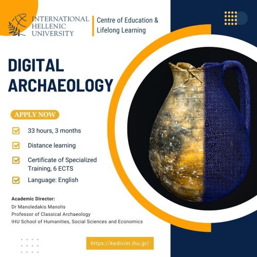
Certificate of Specialized Training
Short description:
New Cycle for 2026: https://kedivim-apply.ihu.gr/en/progs/prog-426
The target audience of this programme is very wide and includes both those with no prior knowledge of the topics that will be presented and those with some experience yet intent on broadening their familiarity. The programme invites the participants to learn about new techniques and means of archaeological research, experiment with them and even challenge them while being conscious of the parameters they should consider before or during a project.
ECTS: 6 ECTS
Tuition Details:
The programme offers a 25% discount (450 euros) to the following categories of applicants:
- Archaeologists (permanent or temporary staff, at Universities, Ephorates of Antiquities, etc.)
- Students
- Graduates of the School of Humanities, Social Sciences and Economics, IHU
- Teachers or professors of Greek public schools/universities
- Unemployed people
- People over 65 years old
- Young people under 30 years old, who hold the European Youth Card
- People from multi-child families
- People with disabilities
- Parents of children with disabilities
- University staff members
- People with annual income less than 12,000 euros
Applicants belonging to more than one of the above-mentioned categories can invoke only one of them.
Early-entry discount (until 9.2.2024): 10% (in addition to the above-mentioned discounts).
Applicants may choose between payment in two (2) equal installments and one-off payment. In the latter case, the fees are 580 euros, or 525 euros in case of early entry.
The payment (or the first installment) must be made by 10 March 2024.
In case of payment in two installments, the second one must be made by 20 April 2024.
Evaluation method:
Interim evaluations will take place at the end of each module.
Scientific director:
Professor Manolis Manoledakis
Academic director:
Professor Manolis Manoledakis
Basic subject:
Social Sciences, Law and Humanities
Subject subcategories:
History/Archaeology
Entry Requirements
- Knowledge of English
- Basic computer skills
Programme's Goal
The programme is addressed to people who are interested in the use of new technologies in archaeology. Topics that will be examined include curation of Digital Archaeological Data, the principles and practical applications of Geographical Information Systems (GIS) in archaeological research, as well as 3D recording techniques that are mostly used for archaeological purposes (photogrammetry, laser scanning, structured-light scanning).
Educational objectives
Upon completing the programme, the students will have:
- understood the significance of new technologies in archaeology
- understood the diverse options available for data curation
- realized that a thorough planning prior commencing any project is necessary in order to guarantee its data transparency and facilitate the future impact it can have resulting by its dissemination
- developed spatial thinking skills and spatial analytical techniques
- answered critical questions on how and why we use GIS
- learned practical applications of GIS in archaeological fieldwork, such as integrating excavation and survey data, database construction, remote sensing and editing vector data
- understood the basics of coordinate systems and how to georeference aerial photographs and other critical datasets for archaeological interpretation
- acquired expertise in creating professional thematic maps of archaeological material
- become able to use and manipulate digital surface models for visualization and analysis.
- become able to perform important spatial analyses in GIS, such as viewshed and cost surface
- acquired a complete view of the main 3d documentation techniques for surface scanning
- familiarized themselves with the processes via visual material
- become able to think more critically on the application of those 3D techniques by being presented with several and diverse showcases and by reviewing their challenges.
- been given the opportunity to practice some of the above in the field, in the archaeological excavation of the International Hellenic University at Neo Rysio, Thessaloniki in June (optionally).
Teaching Staff
The instructors of the programme are archaeologists who are specialized and experienced in the specific fields of Digital Archaeology they are going to teach and have already taught similar courses several times in the past.
- Vassiliki Lagari, Museum of Applied Arts, Vienna
- Jamieson C. Donati, University of Thessaly
Teaching Units - Duration
1. Curation of Digital Archaeological Data
3 three-hours lessons, 2 ECTs
16 March, 23 March and 30 March 2024 (Saturdays, 11.00-14.00)
2. GIS in Archaeology: Theories, Methods and Practical Uses
4 three-hours lessons, 2 ECTs
6 April, 13 April, 20 April and 27 April 2024 (Saturdays, 11.00-14.00)
3. 3D Documentation of Archaeological Objects
4 three-hours lessons, 2 ECTs
11 May, 18 May, 25 May and 1 June 2024 (Saturdays, 11.00-14.00)
Teaching Units Presentation
UNIT 1: CURATION OF DIGITAL ARCHAEOLOGICAL DATA
General description of the course
The increasing digital documentation of excavations together with the digitization of older analogue archaeological archives have risen the need for a structured workflow concerning handling our data. From the creation of a Data Management Plan (DMP) to documentation, preservation, storing, sharing and re-using our data, there are many challenges to be faced.
What types of data should we collect? How will it be collected and who will collect it? How will this data be organised (folder structure, metadata, paradata)? Where are we going to store our data and how will make it accessible (which accessibility degree is allowed)? How will this data be preserved for the long-term?
This course aims to offer an overview of best practices related to data stewardship of data specific to Humanities. An emphasis will be given to the importance of a standardised methodology for organizing and preserving our data according to the FAIR principles (Findable, Accessible, Interoperable, Reusable), while the participants will familiarize themselves with online Research Infrastructures (RIs) such as AriadnePLUS (ARIADNE PLUS – Ariadne infrastructure (ariadne-infrastructure.eu), and with online aggregators such as Carare (Homepage - CARARE) and SeachCulture.gr (https://www.searchculture.gr/aggregator/portal/). Examples of national and international online repositories will show the importance of Open Science within the tendency of democratization of (archaeological) cultural heritage tangible and intangible material.
Course Outline
Lesson 1
- What kind of data do we collect in archaeological contexts (excavations, museums, laboratories)? We will explain the difference between metadata and paradata and the importance of a Data Management Plan that will ensure comprehensible and meaningful recording and storing of everything important to our project.
- FAIR Principles (within this unit the four letters of this acronym will be analysed thoroughly: What makes our data Findable? How is our material Accessible and how do we restrict access if certain datasets cannot be shared? How can we ensure the Interoperability of our data? Are there standards and methodologies that facilitate data exchange? What are the available licences to define the level of the data Reusability?)
- Open Science (we will take a look on the UNESCO Circle of Open Science and visit online repositories and online journals that give us free access to published data)
Lesson 2
In this lecture we will familiarize ourselves with the terms “Research Infrastructure” and “Aggregator”. We will browse over various respective online platforms and we will learn how to use them depending on our purposes. Both regional and broader geographically examples will be showcased and emphasis will be given to archaeology-centred ones.
Lesson 3
This lecture will be a small workshop where the participants will be called to choose between two different tasks: either to create a virtual museum with material sourced from Europeana website (https://www.europeana.eu/en) or to work with archaeological data and their storing to a certain web application (to be announced soon).
Course Goals
After completing the aforementioned introductory units, the students will have a better understanding of this very diverse and tessellated landscape of options available for data curation. They will realise that a thorough planning prior commencing any project is necessary in order to guarantee its data transparency and facilitate the future impact it can have resulting by its dissemination. Starting from the first steps of collecting and documenting information to the later ones of sharing and publishing, the course aspires to contribute to a more homogeneous and inclusive way of handling archaeological data. The students will be able to:
- understand the importance of creating a DMP that outlines how data will be handled during and after a project. It is essential to critically think over the purpose of the project, the expertise and skills of the people involved and the future dissemination of the data.
- learn about the FAIR principles and be able to adjust your data structure in a more standardised and accessible way.
- explore online Research infrastructure platforms and online repositories and be able to discern different types of data and the accessibility level that they have been granted.
- comprehend the knowledge horizons that Open Science offers to both the public and to the research community.
UNIT 2: GIS IN ARCHAEOLOGY: THEORIES, METHODS AND PRACTICAL USES
General description of the course
This course explores the principles and practical applications of Geographical Information Systems (GIS) in archaeological research. Today, GIS is a core component of how we as archaeologists and historians investigate past landscapes and past societies. It complements traditional methods of archaeological inquiry, such as field survey and artefact analysis, but at the same time GIS enables (if applied critically) deeper understandings of spatial data, environmental phenomena and human experiences. Among its many functions in Archaeology, GIS can be used for predictive modelling of movement and networks, multi-scalar data visualization, settlement density maps, and as a relational database of fieldwork finds. What is important to stress is that GIS is not simply a ‘push-button’ tool, but a means of critical analysis in archaeological science.
The target audience of this course are those with no prior knowledge of GIS and those with some experience yet intent on broadening their familiarity. The course offers a balance between the theoretical underpinning of GIS, methods of data analysis and practical uses in the discipline of Archaeology. Weekly on-line lectures are followed by at-home student readings and assignments to develop basic GIS and spatial thinking skills by using real archaeological datasets. A prerequisite for taking this course is to have GIS software on a laptop or desktop computer. Open-source Quantum GIS (QGIS) can be freely downloaded on both PCs and Macs and is recommended. However, other GIS software can be used if available to the student, e.g. ESRI ArcGIS.
Course Outline
Lesson 1: The Basics
Unit 1: Introduction to GIS and its functionality. An overview of GIS, its history and current uses in Archaeology, theoretical issues of practice and potential pitfalls.
Unit 2: Maps and cartographic principles. Introduction to coordinate systems, map projections and transformations.
Unit 3: Geospatial data structure. An overview of vector and raster formats, the function of attribute data and metadata in GIS, and methods for data management.
Lesson 2: Working with Archaeological Data
Unit 1: Importing and editing. Using fieldwork data in GIS, creating and editing points, lines and polygons, and an overview of attribute data and querying (e.g., buffering).
Unit 2: Symbology and classification. Best practices in the visualization of fieldwork data and understanding methods for determining class ranges.
Unit 3: Map design. Practicum on how to create (thematic) maps in GIS, the use of reference grids and scales, and ways to export and share data.
Lesson 3: Working with Satellite and Aerial Imagery
Unit 1: Remote sensing in Archaeology. Acquiring and integrating satellite, aerial and drone-based imagery into GIS, and understanding raster symbology and statistics.
Unit 2: Spatial accuracy. An overview of map rectification and georectifying and dealing with spatial errors in remote sensing datasets.
Unit 3: Image analysis. Using satellite and aerial images to detect ground features of interest, ways to digitize attributes (e.g., fields, rivers) and landscape classification.
Lesson 4: Surface Models and Spatial Analysis
Unit 1: Surface models. Practicum on building and visualizing elevation models and the production of derivatives such as hillshade, slope and aspect models.
Unit 2: Visibility models. Viewshed analysis, problems of interpretation (e.g., uncritical ‘push-button solutions’) and potential remedies.
Unit 3: Route modelling. An overview of cost surface analysis, the calculation of movement using Least Cost Path (or Corridors), and variables in interpretation.
Course Goals
- Develop and encourage spatial thinking skills and spatial analytical techniques.
- Ask critical questions on how and why we use GIS.
- Learn practical applications of GIS in archaeological fieldwork, such as integrating excavation and survey data, database construction, remote sensing and editing vector data.
- Understand the basics of coordinate systems and how to georeference aerial photographs and other critical datasets for archaeological interpretation.
- Acquire expertise in creating professional thematic maps of archaeological material.
- Use and manipulate digital surface models for visualization and analysis.
- Perform important spatial analyses in GIS such as viewshed and cost surface.
UNIT 3: 3D DOCUMENTATION OF ARCHAEOLOGICAL OBJECTS
General description of the course
The course is designed in such a way that it invites students to learn about new techniques and means of archaeological research, experiment with them and even challenge them while being conscious of the parameters they should consider before or during a project. The lectures will mainly focus on the three 3D recording techniques that are mostly used for archaeological purposes (photogrammetry, laser scanning, structured-light scanning) and emphasize the strengths and weaknesses of each one of them.
The students will be also given the opportunity during the second half of the course to follow practical tutorials (3D reconstruction with photogrammetry / 3D reconstruction from drawings) and “visit” virtual environments/digital repositories to examine first-hand the technical processes but also the outcomes of several archaeological endeavours.
Course Outline
Lesson 1
- What is digital archaeology?
- The students will familiarize themselves with the 3D technologies that are used in archaeology, with their strengths and their shortcomings and learning which techniques are better suited for data recording, analysis and preservation in different contexts (e.g. fieldwork, museum)
- They will explore the benefits of 3D scanning in archaeology through examples (archiving and preservation of material, bridging the distance, shape and content calculations, reverse engineering-3D reconstruction, archiving sensitive material and 3D print it, creating reference collection and detect macrotraces, preserving the excavation content, digitally reconstructing past missing content-public and community engagement, repatriation, bringing the 3rd dimension to class)
Lesson 2
- Multimedia in Archaeology (how modern virtual technologies such as VR (Virtual Reality), AR (Augmented Reality), MR (Mixed Reality) present to the public and to the research community a visually more complete view of the past and how they provide us with the opportunity to interpret certain events / objects of antiquity)
- 3D scanning in times of crisis (How can 3D technology aid to the restoration of objects / monuments affected during war and climate crises)
Lesson 3
Tutorial for 3D reconstruction and 3D visualization
- The students will be provided with a dataset of photographs and will produce the 3D model of a ceramic vessel using a software that performs photogrammetric processing. They will continue on a different software and test different ways of visualizing and manipulating the digital object.
Lesson 4
Tutorial for 3D reconstruction from drawings
- The students will reconstruct one ceramic vessel using the Blender software. 2 drawings (2D) will be used in order to acquire the final model: one showing the profile of the preserved part of the object and one showing the complete profile of a parallel vessel (of the same type).
Course Goals
After completing the aforementioned introductory units, the students will have a complete view of the main 3D documentation techniques for surface scanning and they will have familiarized themselves with the processes via visual material. They will be able to think more critically on the application of those 3D techniques by being presented with several and diverse showcases and by reviewing their challenges. The tutorials, that consist half of the course, are structured in such a way to guide inexperienced users through the interface and basic applications of the selected software. Students will be able to:
- understand the basics of 3D scanning techniques and the benefits of 3D documentation for archaeology.
- recognize what each method offers and learn how to develop a workflow suitable for their project and its needs.
- use the tools that certain software offer to create, manipulate (rotate, measure, etc.) a 3D object and visualize it in different ways.
- familiarize themselves with numerous examples from the bibliography and by visiting and working with many others in the web.
- develop critical thinking; the implementation of the methods should be done after a thorough and thoughtful planning, taking into consideration parameters such as the size and material of the object, the time and money available and more; What is the level of precision of our 3D model? What were the conditions during the 3D scanning process?
OPTIONAL PRACTICE
Every year the International Hellenic University carries out a systematic archaeological excavation at the site called “Trapeza of Neo Rysio – Kardia”, in Neo Rysio, Thessaloniki. After the end of the programme, participants will have the opportunity to visit the site and practice some of the skills they will have obtained. More information will be provided during the programme.